Hotels in India »  India Maps » Dadra and Nagar Haveli Map

Dadra and Nagar Haveli Map

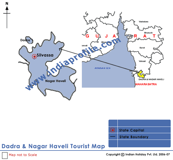
India Profile brings you the Dadra and Nagar Haveli map that shows you the important tourist places in Dadra and Nagar Haveli. Dadra and Nagar Haveli, in West India is a Union Territory of India located between Gujarat and Maharashtra. On the Dadra and Nagar Haveli map you can see its capital Silvassa and other tourist destinations in Dadra and Nagar Haveli. To know more about Dadra and Nagar Haveli India, just take a look at the Dadra and Nagar Haveli map.

Dadra and Nagar Haveli Map

Maps of India
Andhra Pradesh Map Arunachal Pradesh Map Assam Map Bihar Map
Chhattisgarh Map Delhi Map Goa Map Gujarat Map
Haryana Map Himachal Pradesh Map Jammu & Kashmir Map Jharkhand Map
Karnataka Map Kerala Map Madhya Pradesh Map Maharashtra Map
Manipur Map Meghalaya Map Mizoram Map Nagaland Map
Orissa Map Punjab Map Rajasthan Map Sikkim Map
Tamil Nadu Map Tripura Map Uttar Pradesh Map Uttaranchal Map
West Bengal Map      
       
Tourist Maps of Union Territories of India
Andaman & Nicobar Map Chandigarh Map Dadra & Nagar Haveli Map Daman & Diu Map
Lakshadweep Map Pondicherry Map    
       
Tourist Maps of Metro Cities of India
Delhi Map Mumbai Map Chennai Map Kolkata Map
Bangalore Map Hyderabad Map Pune Map  


India Profile offers maps of Dadra & Nagar Haveli India and information on tourist places in India. For more information or to book a tour, please enter your query in the form below.