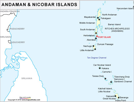
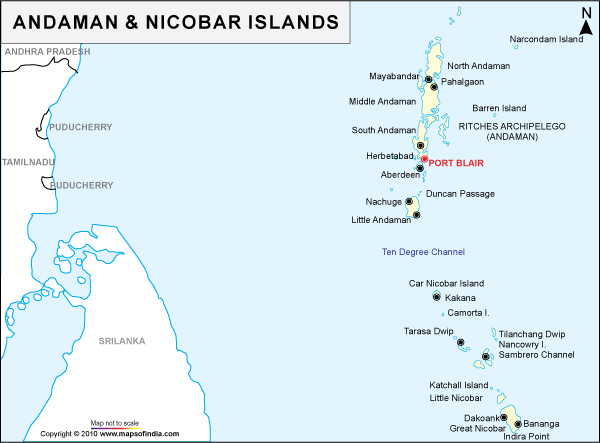
Andaman and Nicobar Islands Map
India Profile brings you the Andaman and Nicobar Islands map that shows you the important tourist places in Andaman and Nicobar Islands India. Andaman and Nicobar Islands, in the Bay of Bengal is a Union Territory of India known for its beautiful beaches, coral reefs and tribal culture. On the Andaman and Nicobar Islands map you can see the capital city Port Blair and the rest of these scenic islands. To know more about Andaman and Nicobar Islands India, just take a look at the Andaman and Nicobar Islands map.