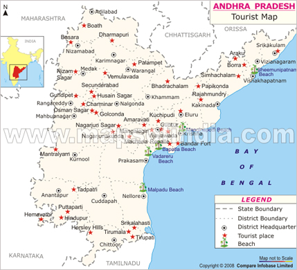
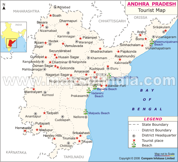
India Profile offers maps of Andhra Pradesh India, and information on tourist places in Andhra Pradesh India
India Profile »  India Maps » Andhra Pradesh Map
Andhra Pradesh Map

India Profile brings you the Andhra Pradesh map that shows you the important tourist places in Andhra Pradesh India. Andhra Pradesh is the largest state in Southern India. It is known for the mixture of Hindu and Islamic cultures in its capital city Hyderabad. On the Andhra Pradesh Map you can see the tourist destinations of Vijaywada, Visakhapatnam, and Nagarjunasagar. The Pilgrimage destinations of Tirupati and Puttaparthi are other popular tourist places in Andhra Pradesh India the you can see on the Andhra Pradesh map.

Andhra Pradesh Map

Maps of India
Andhra Pradesh Map Arunachal Pradesh Map Assam Map Bihar Map
Chhattisgarh Map Delhi Map Goa Map Gujarat Map
Haryana Map Himachal Pradesh Map Jammu & Kashmir Map Jharkhand Map
Karnataka Map Kerala Map Madhya Pradesh Map Maharashtra Map
Manipur Map Meghalaya Map Mizoram Map Nagaland Map
Orissa Map Punjab Map Rajasthan Map Sikkim Map
Tamil Nadu Map Tripura Map Uttar Pradesh Map Uttaranchal Map
West Bengal Map      
       
Tourist Maps of Union Territories of India
Andaman & Nicobar Map Chandigarh Map Dadra & Nagar Haveli Map Daman & Diu Map
Lakshadweep Map Pondicherry Map    
       
Tourist Maps of Metro Cities of India
Delhi Map Mumbai Map Chennai Map Kolkata Map
Bangalore Map Hyderabad Map Pune Map  


India Profile offers maps of Andhra Pradesh India and information on tourist places in India. For more information or to book a tour, please enter your query in the form below.