| ||
|
| ||
India Profile >> India Maps >> Jammu & Kashmir Map
Book Your Tour Now

Jammu & Kashmir Map
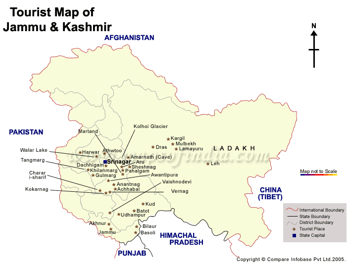
India Profile brings you the Jammu and Kashmir map that shows you the important tourist places in Jammu and Kashmir India. Jammu and Kashmir, the northernmost state of India is a land of immense natural beauty. On the Jammu and Kashmir map you can see the capital city Srinagar and the tourist places of Jammu, Gulmarg, Anantnag, Baramullah, Ladakh and Leh. To know more about Jammu and Kashmir India, just take a look at the Jammu and Kashmir map.
| Maps of India |
| Tourist Maps of Union Territories of India |
| Andaman & Nicobar Map | Chandigarh Map |
| Dadra & Nagar Haveli Map | Daman & Diu Map |
| Lakshadweep Map | Pondicherry Map |
| Tourist Maps of Metro Cities of India |
| Delhi Map | Mumbai Map |
| Chennai Map | Kolkata Map |
| Bangalore Map | Hyderabad Map |
| Pune Map | |